• Blog
  • Portfolio
  • Landscapes
  • Wildlife
    • Alaska
    • Grand Teton
    • Yellowstone
    • Glacier Park
    • Rock City
    • Lost Lake
    • Memorial Falls
    • Freezout WMA
    • Benton Lake NWR
    • C. M. Russell NWR
  • Astrophotography
  • About
  • Contact
Menu

Josh Rutledge Photography

  • Blog
  • Portfolio
  • Landscapes
  • Wildlife
  • Places
    • Alaska
    • Grand Teton
    • Yellowstone
    • Glacier Park
    • Rock City
    • Lost Lake
    • Memorial Falls
    • Freezout WMA
    • Benton Lake NWR
    • C. M. Russell NWR
  • Astrophotography
  • About
  • Contact
×

This mother polar bear and her two cubs on the beach of Hudson Bay were trying to sneak behind this male polar bear that is out of focus on the left of the frame. Female polar bears with cubs try to avoid male bears. There were two additional bears out of frame, so for a couple of minutes there were 6 bears around us.

Churchill - Polar Bear Capital of the World

Joshua Rutledge November 25, 2024

My sister Melissa and I recently returned from an amazing trip to Churchill, Manitoba, Canada to photograph polar bears. Churchill is located on Hudson Bay, and it is an area where polar bears congregate every fall while they wait for the bay to freeze over so they can go out on the ice to hunt for seals. The reason the bay starts to freeze there first is actually because of the Churchill River that empties into the bay. The fresh water in the river freezes much earlier than the salt water, so the ice from the river collects in the bay and that helps the bay freeze over faster than it would otherwise. Typically the end of October or early November is considered the prime time to view the polar bears, so we scheduled our trip accordingly. Once the bay freezes over, the polar bears disperse and are no longer in the area, so you do need to be there before ice over. The exact timing of the freeze varies from year to year and is trending towards later in the season. You can find polar bears around Churchill earlier in the fall however, but maybe just not in as high of concentrations. Pregnant females will also hibernate in the area, especially in the nearby Wapusk National Park. The local guides we talked to said the bears seem to be showing up earlier and earlier however, and it is not uncommon to see them even in July now. Churchill is also known for its summer concentration of beluga’s whales and the Northern Lights. So if you time it right, in maybe late August or so, they said you might be able to get the trifecta and see polar bears, belugas and the Northern Lights all in one visit! Speaking of the Northern Lights, we had cloudy/snowy conditions most of the time while we were there, so we never did get to see them. We did see them on our trip home while on the train however. They consider their “Northern Lights season” to be later in the winter or even early spring when the skies tend to be less cloudy. You have the chance to see them there almost 300 nights out of the year though. We have been lucky the last couple of years here in Montana that we have had some spectacular Northern Lights shows, so we were not quite as disappointed that we did not get to see them. If you are interested, I do have a couple of blog posts from our events here. 

Northern Lights - March 2023 

Northern Lights -April 2023

We started planning this trip almost a year ago. I really should say my sister Melissa started planning this trip. She was a rock star and made almost all of the arrangements, so I owe her a big thank you for that. We (my wife, my sister and I) visited Katmai National Park in the fall of 2023, and I think that might have served as an inspiration for this trip. I think having photographed the brown bears in Alaska, the polar bears kind of felt like the next natural step. We were already aware of Churchill at that point, and it seemed like the most accessible option to see the bears. The other popular option is Svalbard in northern Norway.  I do have a blog from Katmai National Park as well if you want to check it out.

As soon as we started researching the trip, we discovered that much like Katmai National Park, you cannot drive to Churchill. You have to either fly in or take the train. The most common jumping off point for either option is via Winnipeg, Manitoba. If you decide you want to take the train, there are other options as well, which is what we chose to do. We decided we would drive to Thompson, Manitoba and get on the train there. The drive to Thompson is actually farther than driving to Winnipeg for us, but the train ride would have been a lot longer, so we decided to save time by driving ourselves. Obviously the fastest option would have been by plane out of Winnipeg, but that was a fairly pricey option. We also had concerns about trying to get that much gear on the plane, since besides all of our camera gear, we knew we would have a lot of bulky cold weather gear as well. Plus the train just sounded like a bit of an adventure in itself. Once we checked the train schedule, knowing we wanted to be there around the end of October or early November, that helped us pick our dates and we were able to reserve a hotel room and book some tours in Churchill. I would recommend booking those things as soon as you know you are going, as they fill up fast. 

We started our trip from my sister’s house in Lewistown, MT. I drove over the night before from Great Falls, so we could get an early start. According to the mapping app we used, it was going to be a little over 16 hours of driving time to get from her house up to Thompson. We knew with the shorter fall days we would need to break up the drive over a couple of days. We decided to aim for the small town of Nipawin in Saskatchewan as our first stop. We booked a hotel in town so we would be sure to have a room when we got there. By the time we got through the border and made a few stops, it was probably about a 12 hour day. Speaking of the border, we crossed at the Morgan/Monchy Port north of Malta, Montana. It is a very small crossing, so you may want to check ahead to be sure it will be open when you want to make the crossing. We noticed it was only open from 9 to 5 on weekdays, so we were lucky we were going on a Thursday and we got there after 9am. The crossing was very easy, they just asked a few questions and checked our passports, and we were on our way. We then continued north eventually going through Saskatoon and then east over to Nipawin, arriving there shortly after dark. We stayed at the River Inn Hotel and there was a little chicken joint called Chicken Delight downstairs that we decided to have dinner at. It worked out pretty well staying there. It was Halloween, so there were a few people around trick or treating, but it was still pretty quiet.  

I love Tim Hortons, I wish we had them down here.

The next morning we got up early and started on the second leg of our journey to Thompson. Of course we had to stop at Tim Hortons to get some coffee and a donut. When in Canada! Not far out of Nipawin the road turned into gravel. This was obviously not ideal and was probably something we should have looked into a little closer. We did not have any issues, and as gravel roads go, it was a pretty well maintained road, but it was still not the best idea. The road traveled through a kind of a conservation area, so there were a lot of trees and wetlands that were interesting to drive through, but not a lot else. Eventually it did turn back into pavement as we got closer to crossing into Manitoba and eventually to The Pas. After a couple of other stops along the way, we arrived in Thompson in the early afternoon. The train was scheduled to leave around 5PM, so we had plenty of time to grab some dinner and get settled in at the train station. We took a chance and decided to leave our car parked at the train station. This is probably not your best option however, as even the train station recommends against it. The train station is a ways out of town and is kind of in an industrial area with no one really monitoring things. We were told there are some options for places where you can park your car in town that are more secure for a small fee or donation. We heard that maybe the fire department would let you park there, maybe the police station, and we also heard from some fellow travelers that one of the hotels in town would let you as well. You can then either take a taxi or a shuttle service out to the train station. We did not have any issues parking there, but as I said, if we did it again we would have probably found some better options just to be safe. 

Selfie of Melissa and I on the train.

We boarded the train shortly before 5PM. The train station there is small, and the boarding process was fairly informal and in my opinion a little chaotic. I don’t know if that is typical or not, but that was our experience. The train was pretty full, I would say maybe a little over half appeared to be fellow tourists to Churchill and the other half were locals that use the train to get between some of the smaller villages along the way. Since it was going to be an overnight trip, we decided to pay more and we got a sleeper car. I don’t know that this was necessary, but the extra privacy was nice. If you are looking to save some money there are cheaper options (even some that include a bed.) The “room” is pretty small, especially once the beds are pulled out, but it was adequate. This line is very stripped down service wise however, so don’t expect served meals or some of the amenities you would normally get taking the train elsewhere. There were some snacks available and you could buy some “hot food”, but it was just prepackaged items that were microwaved for you. Since we had already eaten an early dinner before we got on the train and had brought some snacks with us, we were fine. The train did include a domed car that was nice for some places where you could stretch out a little bit and see some of the scenery. Of course, the train left late enough in the day, that this time of year it was dark within an hour or so of us leaving the station, so there was not a lot to see. If you were traveling by train in the summer when the days are longer, I could see this being more of a highlight. My sister did get up on our return trip to go into the dome, and she was able to see the Northern Lights! 

The front of the Churchill Train Station. It is a fairly historic building and has been restored and updated.

Early the next morning we arrived in Churchill. The train was scheduled to arrive around 9AM, but we arrived before 8AM. They have been making improvements to the line, and they said their goal is to try and start having the times reduced by quite a bit. In fact, they pushed our departure time back by an hour on our way home and left the arrival time the same, assuming we would make up an hour in travel time. But they obviously still have some work to do, as we ended up being almost exactly an hour late coming back. The train to Churchill does have a bit of a history and it can be a difficult route to keep intact because of the muskeg that is always thawing and freezing causing the land (tracks) to heave and sink. The line was actually shut down all together for a few years because the train operators said it wasn’t worth the efforts, but the Province of Manitoba agreed to take over maintenance of the line and VIA contracts to run the trains for them. I think that may play into why the services offered on this line are reduced as well. If you are planning on taking the train, I would make sure you check in regularly to make sure the schedules doesn’t change, as it seems to be a bit of a moving target right now.

A sign inside the train station talking about the history of the station a bit.

Once we departed the train and got our checked baggage, we hung out in the station for a bit of time waiting for our shuttle service to the hotel. There is actually a nice little visitors center inside of the train station, and they have someone from the park service that will provide you with information from right in the train station. They also had some maps of the area that were helpful. We eventually found out that our ride was actually there the whole time, but we didn’t realize it. The hotel we were staying at, the owners actually have a couple of different hotels in town, so the name on the shuttle was not what we were looking for. Churchill is a small place, so we found that almost everyone knew everyone, and oftentimes there was kind of cross pollination between things. For example, as I mentioned, the same people owned multiple hotels, and the son of the owner was actually the shuttle driver for us and he owned a restaurant in town, amongst other duties. And his wife was one of our guides later in our visit, and she also worked for other entities in town as well. The hotel owners also own the car rental service in town. Everyone we met was very nice, but there was a fairly casual and informal way about things.

The sign for the Bear Country Inn.

After we got the shuttle situation figured out, he gave us a quick tour of town to give us the lay of the land and where things were at. He then dropped us off at our hotel. We stayed at the Bear Country Inn. The owner is named John and he was a bit of a character. I actually liked him, but I don’t think my sister cared for him as much. I don’t think she quite got his humor, and that is ok. Check-in time was not until 3PM, but he was very nice and found us a room right away that morning so we could put our stuff away. If not, they do have an area behind the desk where they will let you keep your stuff. We did take advantage of that on our departure day since our train was not leaving until later that evening. The hotel is just a basic hotel, they do offer a basic breakfast, it’s nothing fancy, but it was more than adequate. Obviously we were there to experience things, so we didn’t spend that much time in the hotel anyway.

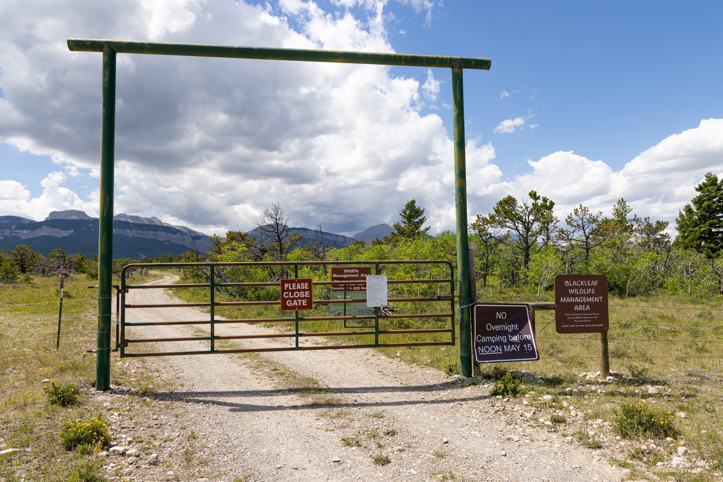
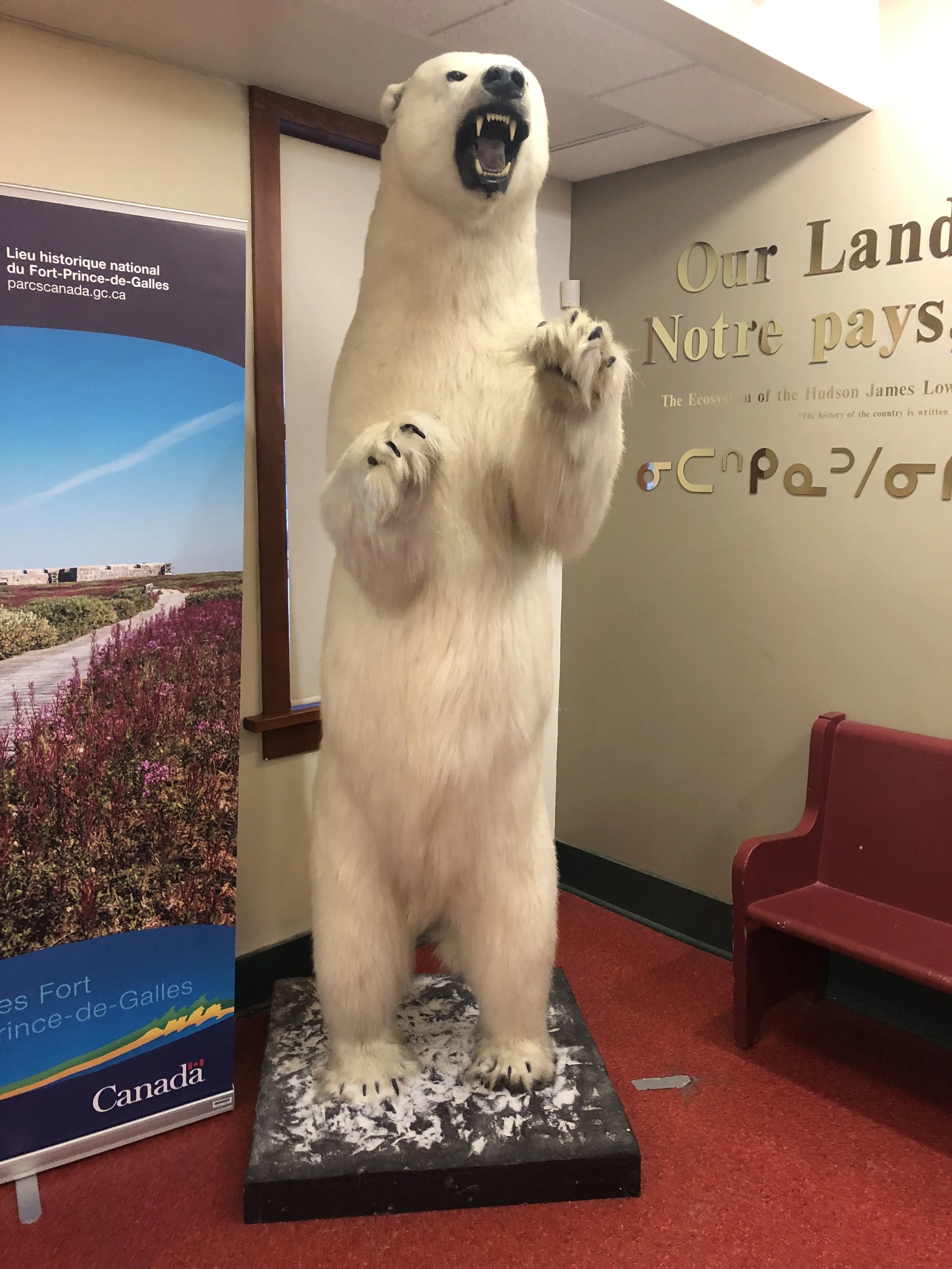
Since we were not sure how our first morning would go, if the train would be on time, and etc, we had purposely not booked anything for our first day there. I think that was actually a good choice. That gave us basically a whole day to wander around town and look at things that we might not have got a chance to otherwise. The main area of town is very small, so you can easily walk the whole thing. There are a lot of murals painted on buildings around town that are fun to find. There are a few gift shops in town, as well as a grocery store, a hardware store and a few other things like that. A lot of the gift shops are part of the tour companies and/or hotels/restaurants. There are also a lot of cool little displays in town that make for good photo ops. There are statues, rock formations, informational signs, there is an old boat closer to the bay, and lots of little things to check out.There are also a couple of museums and informational centers in town that are worth checking out, including the Itsanitaq Museum and the Polar Bears International. Farther out of town there is also the Churchill Northern Studies Center. You do need to always be aware of your surroundings when you are exploring in Churchill, even in town. The polar bears do come into town, and obviously this could be a dangerous situation. There are signs pretty much everywhere warning you to be careful and telling you not to go to certain areas.

You can select the individual photographs from the gallery below for a larger view.

View fullsize Polar bear at the train station.
Polar bear at the train station.
View fullsize Polar Bears International Interpretive Center.
Polar Bears International Interpretive Center.
View fullsize Itsanitaq Museum Sign
Itsanitaq Museum Sign
View fullsize Walrus in the museum.
Walrus in the museum.
View fullsize Wolf in the museum.
Wolf in the museum.
View fullsize Polar bear in the museum
Polar bear in the museum
View fullsize Ptarmigan in the museum.
Ptarmigan in the museum.
View fullsize Arctice fox in the museum.
Arctice fox in the museum.
View fullsize Sign for the Itsanitaq museum.
Sign for the Itsanitaq museum.

On the subject of restaurants, one thing we did find out after we got there, is that it can be very difficult to get a dinner reservation in town. Unfortunately for us, a lot of the bigger tour groups book the restaurants so they can provide meals for their clients. If you were willing to eat later or share a table with other guests, sometimes you could get a reservation. Finding breakfast or lunch was not difficult however, since most people were out in the field during those times. The food we did have was all very good. And the prices, while higher than other places, were actually not as bad as I thought they might be, especially when figuring in the favorable exchange rate. We ate at the Tundra Pub our first night, and it was good. They did have a couple of large groups in, but luckily we got there early enough that they did have a couple of tables still available. We ate dinner, lunch, and I think even a breakfast at the Seaport Hotel. All of our meals there were good as well. We had hoped to eat at the Ptarmigan, which is one of the newer/nicer restaurants in town, but we were never able to get a reservation. We also never got over to the Dancing Bear, which I think is a little more casual and also offers pizzas. One evening we ended up eating at a food truck that was serving Asian inspired food. Two of our tours had lunch included, and as I mentioned the hotel offered a basic breakfast, so it was really only dinner we had to worry about.

A breakfast scramble from the Seaport Hotel breakfast. Elk meat loaf and putine from the Tundray Pub. Bison burger at the Tundra Pub. Seafood pasta and beef and veg soup from Searport Hotel. Poutine and a steak sandwich from Seaport Hotel.

That is probably enough about Churchill the town for now, as I am sure most of you are here for the polar bears. If you are going to be visiting Churchill, I would encourage you to do a little research about the town however and see what all it has to offer that you might be interested in, and make sure you leave yourself a little bit of time to explore those things. If you have any questions I can help with, feel free to contact me on my contact page. 

You can select the individual photographs for a larger view in the gallery below.

View fullsize Polar bear mural.
Polar bear mural.
View fullsize Another polar bear mural.
Another polar bear mural.
View fullsize Rock statue right on Hudson Bay.
Rock statue right on Hudson Bay.
View fullsize Quircky weather sign.
Quircky weather sign.
View fullsize Shipwreck of the MV Ithaca.
Shipwreck of the MV Ithaca.
View fullsize Wolf mural.
Wolf mural.
View fullsize Informational sign about the whales around Churchill.
Informational sign about the whales around Churchill.
View fullsize Another sign about other wildlife around Churchill.
Another sign about other wildlife around Churchill.
View fullsize Polar bear and wolf mural.
Polar bear and wolf mural.
View fullsize Signs warning visitors to not enter certain areas.
Signs warning visitors to not enter certain areas.
View fullsize The Ptarmigan boat display.
The Ptarmigan boat display.
View fullsize Another mural in town.
Another mural in town.
View fullsize Bear crossing sign.
Bear crossing sign.
View fullsize Polar bear print in the snow.
Polar bear print in the snow.

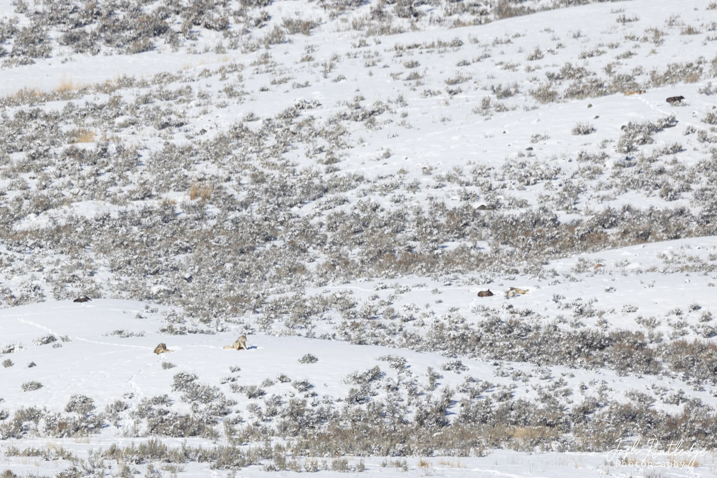
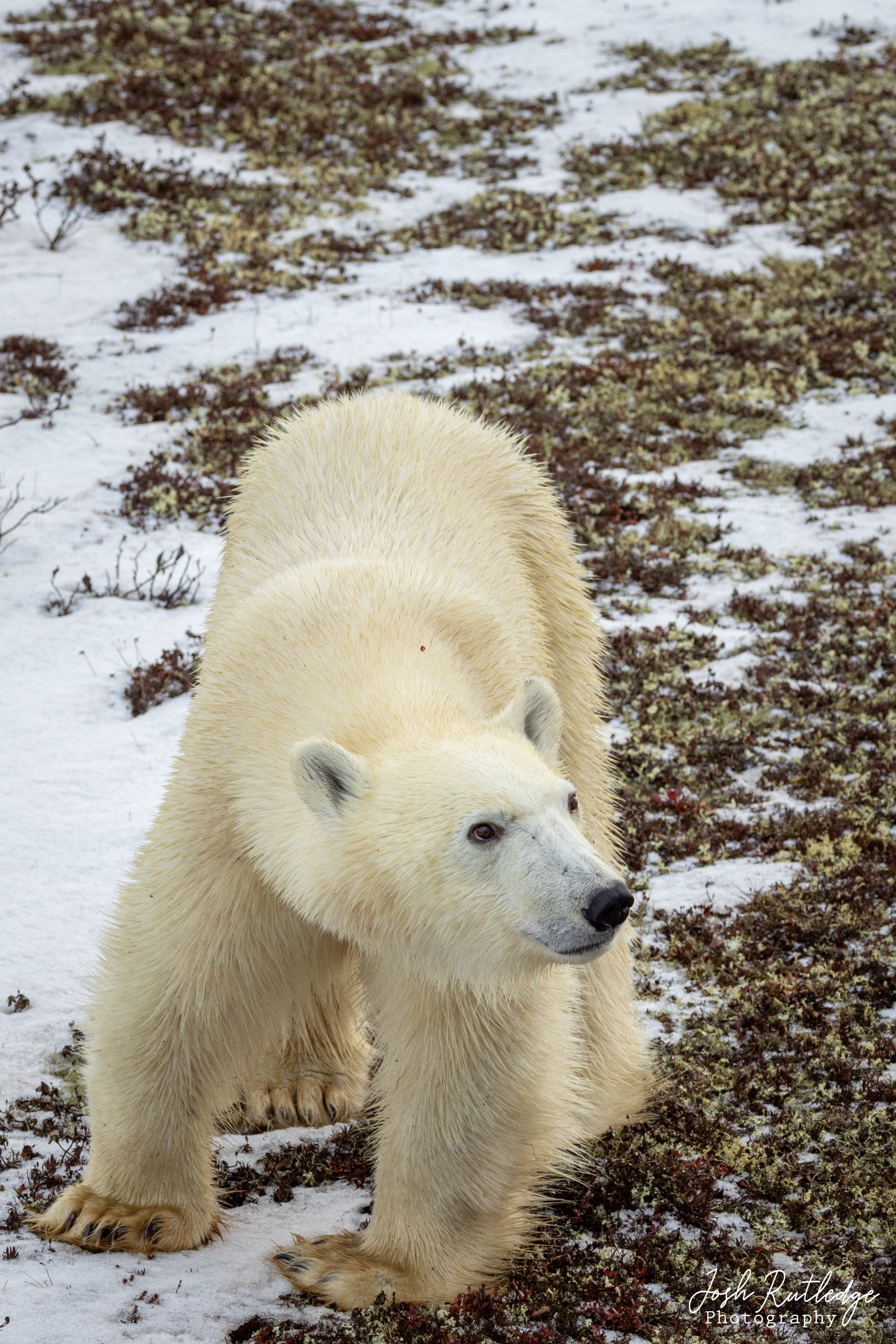
This mother polar bear and her two older cubs were resting out in a flat near Hudson Bay.

Our first full morning we had a tour scheduled with Nanuk Operations. We joined a group of 4 that had already been in Churchill for a couple of days and our guide was named Jaime. He picked us up at our hotel and off we went. We were actually awoken early in our hotel room that morning from some poppers going off. These were conservation officers trying to haze a bear out of town. They use loud noises and other methods to try and deter the bears from coming into town. Since our guide knew a bear had been hazed out of town earlier, he first took us out to where he thought it might have been heading. This took us by the old grain port on the outside of town near where the Churchill River meets Hudson Bay. We did not actually find any bears out there, but I am glad we went, as it was the only time during our trip we made it out to that area of town. We then made our way back through town and only made it a short distance and we spotted our first bear. It was near the cemetery and was just walking across this open area between us and the only major road heading out of town. Since it was so close to town, eventually some conservation officers showed up and chased it away from town towards the river. It was still fairly early in the morning at this point, and it was a bit overcast, so from a photography perspective it was not the greatest, but it was still awesome to have our first sighting.

Our first polar bear sighting of the trip.

Our first polar bear passing in front of us.

We then headed out to “Polar Bear Alley” which is kind of the area down by the beach on Hudson Bay. There are a lot of rocks, brush and other areas where the bears like to hang out, and it forms a kind of natural corridor for them to travel, so that is why they call it Polar Bear Alley. Our first sighting in Polar Bear Alley was a mother with two cubs a ways out in a clearing. It was then I realized that I had forgotten my teleconverter at the hotel that day. I was wishing I would have had it to bring them in a little closer. They were still fun to watch, but a little bit too far away for any great photos. It wasn’t too much later that we spotted a bear walking down the beach. It was low tide, so they like to walk the tidal zone to see if there is anything washed up to eat. Our guide was able to anticipate where he thought the bear was going to go, and got us into a great position for photography. I really appreciated this about Jaime, as he did understand the photography aspect of the tour. Some of our other guides, while great in their own way, did not necessarily understand the photography side of things as much. 

You can select the individual photos from the gallery below for a larger view.

View fullsize Polar bear on the beach enjoying the sun
Polar bear on the beach enjoying the sun
View fullsize Closer up of the polar bear on the beach.
Closer up of the polar bear on the beach.
View fullsize Polar bear with Hudson Bay behind it.
Polar bear with Hudson Bay behind it.
View fullsize Polar bear walking along Hudson Bay.
Polar bear walking along Hudson Bay.
View fullsize Portrait of a polar bear.
Portrait of a polar bear.
View fullsize Wider environmental shot of a polar bear in the low tide.
Wider environmental shot of a polar bear in the low tide.

Eventually we headed out to the Churchill Northern Studies Center (technically it’s “Centre” since it’s Canada) for lunch. The Center is a research facility and hosts a lot of projects and programs there. We made use of their cafeteria for lunch and also made a quick stop in the gift shop there. The Center is quite a ways out of town, and is near where there used to be a rocket testing facility. Some of the old buildings from the rocket testing days are still visible.

After lunch we headed out to the Churchill Wildlife Management Area. This area sits adjacent to the Wapusk National Park and is kind of behind the Study Center. This is also the area where the “tundra buggies” operate. I will get into those more later on. If you have a permit you are allowed to go on the established roads, but only the buggies are allowed to go to areas off road. We saw several bears in the distance coming into the management area, and eventually we found a bear relatively close near a rock formation. We watched it for quite a while and then we eventually saw a mother bear with two cubs coming across the ice in our general direction. We decided to stay in the area to see how close she would get. While we were watching her, we saw a red fox running out on the ice as well. We saw several red fox during our visit, but we never got any great photos of one. And we never saw any silver fox (a blackish color morph of a red fox) or arctic fox, which were on our wish lists of things to see. Our guides said the arctic fox has had a bit of a die off and they don’t see them as often anymore. The red foxes seem to be out-competing them there.  Anyway, eventually the polar bear with the two cubs did come all the way across the ice, and after disappearing into the willows for a little while, they emerged pretty close in front of us. We were able to get a few pretty good pictures, before they proceeded to walk in front of us towards the rocks where we had seen the other bear earlier. As we were heading back out of the management area, we had a couple of other encounters with bears. We had one large bear up on the rocks that made for some great pictures. And we had one very curious bear that ended up getting way too close to us, and we had to retreat back into the van. Our guide made a lot of noise and was eventually able to get the bear to move along. It did make for a pretty exciting encounter. 

Select the individual photos from the gallery below for a larger view.

View fullsize Polar bear in front of some dark rocks.
Polar bear in front of some dark rocks.
View fullsize Polar bear approaching us.
Polar bear approaching us.
View fullsize Polar bear portrait.
Polar bear portrait.
View fullsize Mother polar bear and two cubs crossing the ice.
Mother polar bear and two cubs crossing the ice.
View fullsize Red fox out on the ice.
Red fox out on the ice.
View fullsize Mother polar bear and two cubs on the beach behind the willows.
Mother polar bear and two cubs on the beach behind the willows.
View fullsize Mother polar bear and two cubs posing for me.
Mother polar bear and two cubs posing for me.
View fullsize An armed guide making sure everyone was save the mother polar bear and two cubs crossed in front of us.
An armed guide making sure everyone was save the mother polar bear and two cubs crossed in front of us.
View fullsize Large polar bear up on the rocks.
Large polar bear up on the rocks.
View fullsize Polar bear resting on the rocks.
Polar bear resting on the rocks.

All in all we had a great first day out and about. I believe we ended up seeing about a dozen bears total. We both really enjoyed our guide and had kind of wished we had booked more than one day with him. Nanuk Operations were top notch and very professional. Prior to our tour they were great with keeping in touch and making sure everything was good to go. I wish I had a link to Jaime’s social media or something so I could tag him.

We had a full 8 or 9 hour day out on the tour, so it was getting dark by the time we got back to town. I believe this was the night we had dinner at the Seaport Hotel. Our first night we had dinner at the Tundra Pub. Both meals were great. We then settled into the hotel, recharged our camera batteries and got ready for the next day.

Great White Bear Tours Polar Rover.

Our second day of touring we had a tour scheduled with Great White Bear Tours. This is one of the companies that operate tundra buggies out on the Wildlife Management Area I referenced earlier. I do need to clarify that “Tundra Buggy” is a trademarked name. I believe Frontiers North owns that name. So Great White Bear calls theirs “Polar Rovers.” There is a third company permitted to operate in the Management Area, but I cannot remember what they call theirs now. The term “tundra buggy” is kind of like using Kleenex though, everyone just calls them all tundra buggies regardless of what company is operating them. The buggies are mostly all based off a fire truck chassis they build up for the vehicles.

A plaque on the back of the seats of the Polar Rover.

Great White Bear picked us up at our hotel, and after picking up several other guests around town, we headed out to their facility near the Management Area. They have built a ramp out at their facility that rovers can back up to, so you are able to walk off the shuttle and directly onto the rover without having to climb up and in. The rovers sit high up in the air, so this is a nice setup. I think the other companies have you climb up onto a loading dock to get onto the buggy. The Great White Bear rovers do have a private flushing toilet on board, so that is nice. They said that was a fairly new feature of their rovers, so they are not sure if the other companies have something similar now too or not.

Looking back at the Great White Bear Tours facility as we are pulling away.

We pulled away from the loading area and headed out into the Management Area. The rovers are built to go over ice, rocks, mud and etc, so they move pretty slow and the ride can be a little rough. Since they sit up so high, they do tend to rock back and forth a lot too. I mention this, because if you are prone to motion sickness, this might be something to be aware of. We did not have anyone get sick on ours, but there was a passenger on ours that had been out previously and they stated someone did get sick on their other tour.

A polar bear walking in front of another Polar Rover.

We had a great day out on the rover. We had several close up interactions with bears that would come right up the rover. Other bears would kind of keep their distance. Every bear kind of has its own personality. They did serve lunch on the rover, which consisted of beef stew, a dinner roll, cookies and a drink. They also had opportunities to get hot chocolate and coffee. The spot we chose for lunch was good, as the temperatures were just warm enough by the afternoon that some of the ice was melting. This created some pools of water on the ice and as the bears would walk out onto the ice you could see the bear’s reflections in the water. None of my pictures turned out all that great, probably because of the temperature differences between the cold ice and the warm air was creating a mirage, but it was still cool to see. Eventually we headed back to the loading area and we saw a few bears on our way out. I believe we saw around a dozen bears or so again this day.

You can select the individual photos from the gallery below for a larger view.

View fullsize Large polar bear laying in the grass.
Large polar bear laying in the grass.
View fullsize Polar bear with two older cubs.
Polar bear with two older cubs.
View fullsize Polar bear with two cubs passing outside the rover windshield.
Polar bear with two cubs passing outside the rover windshield.
View fullsize Polar bear looking over it's shoulder.
Polar bear looking over it's shoulder.
View fullsize Young polar bear right below me next to the rover.
Young polar bear right below me next to the rover.
View fullsize Polar bear under another rover.
Polar bear under another rover.
View fullsize Polar bear and reflection on the ice.
Polar bear and reflection on the ice.
View fullsize Another polar bear ice reflection.
Another polar bear ice reflection.
View fullsize Seal sitting out on an iceberg in Hudson Bay.
Seal sitting out on an iceberg in Hudson Bay.

From a purely photography perspective, the tundra buggies are probably not the most conducive to getting the best shots. But you do see the bears in a different way then you would otherwise, so I think it’s still worth spending at least one day touring this way. Once we got back to the loading area, we loaded the shuttle and they took us back to our hotel. We ended up grabbing some dinner at a food truck after again not being able to get a table at a restaurant.

Nearing sunset over the Wildlife Management area at the end of our day on the rover.

Our last day in Churchill we had a tour scheduled with Sub-Arctic Tours. Our train was not scheduled to leave until 7PM that night, so we had plenty of time to fit in one more full day tour. Our guide was a Churchill native named Stanley. He was a really interesting guy who had done a lot of different things during his life. He was in the military and had been on some award winning marksmanship teams. He worked at the large grain port in town as a younger man and had retired from working as a maintenance worker at the large community building in town. He took us around to a lot of little spots around Churchill that we had not seen yet. This included the Polar Bear Holding Facility, known as “Bear Jail” and a crash site of a plane that was overloaded back when the military base was there. So that was great. I guess I should have mentioned that it was a cold blizzardy day. It was the only day that really felt cold, we had been pretty lucky up to that point. Sub-Arctic Tours has a couple of different options for tours, but we chose an option where we were just in a pickup, hoping that would ensure it was just the two of us (and the guide), and that was the case.

Two male polar bears sparring with each other. They were not seriously fighting, they were just kind of pushing each other around.

The blizzard conditions were not ideal for photographing wildlife. I don’t think our guide had quite as good of understanding of photography either. He was great at knowing the local areas and finding wildlife, but he didn’t really understand as well getting us into good situations for getting photographs of the wildlife. I guess we could have been a little more vocal about what we wanted some of the times, so some of it is probably on us. We did eventually come across two male polar bears sparring with each other. So that was probably one of my highlights from the trip. The wind was blowing so hard, and there was so much snow swirling around, that it was very difficult to get any good photos. After a while a lot of other people and tour groups found the location, and it got pretty crowded. We eventually left to see what else we could find, but we determined that it was probably the best show in town. But when we went back, the scene had got even busier, so we were not even able to park anywhere near where the bears were. We saw several foxes that day, but we didn’t get any photos and we did find some ptarmigan out feeding in the storm. I did get some photos of them, but between the wind and the blowing snow none of them turned out great. 

You can select the individual photos for a larger view from the gallery below.

View fullsize Male polar bears sparring.
Male polar bears sparring.
View fullsize Polar bear biting another on the rear.
Polar bear biting another on the rear.
View fullsize Polar bear spun around after getting bit.
Polar bear spun around after getting bit.
View fullsize Polar bear resting in the rocks.
Polar bear resting in the rocks.
View fullsize Ptarmigan in the storm.
Ptarmigan in the storm.
View fullsize Plane crash near town.
Plane crash near town.
View fullsize Polar Bear Jail.
Polar Bear Jail.
View fullsize New vs old polar bear traps.
New vs old polar bear traps.
View fullsize Old radar base with mural.
Old radar base with mural.

This polar bear was staying out of the storm by sleeping next to some rocks.

We ended the day out in the Wildlife Management area again. We finally found a bear that was riding out the storm by just sleeping in the rocks. It would occasionally raise its head to look around, but that was about it. Our guide then took us back to our hotel and we just kind of hung out until it was time for a ride back to the train station. John, the hotel owner, gave us a ride back personally, so that was nice. We hung out in the train station for a bit, before starting our journey back home. To avoid the gravel road we ended up on going up, we took a more southerly route out of Thompson. This route took us through Regina and Moose Jaw, but eventually coming back through the same port of entry north of Malta. On the way home we stayed in the town of Swan River. We did not have the best hotel experience there, so I am not including that location in this blog.

Going into this trip I struggled with what to bring. From a photography standpoint, of course I wanted to include everything but the kitchen sink. Since we were not taking a plane, I didn’t feel quite as restrained, but I still had to prioritize what I wanted to bring. I settled on bringing my 2 Canon R5 bodies, the Canon 600mm F4 version II, my Canon RF 100-500, Canon RF 24-105 F4, Canon EF 70-200 2.8 Version III and in case we had Northern Lights I included my Canon RF 15-35 2.8 lens. I did not end up ever using the 70-200 or the 15-35. I also brought my GoPro Hero 10 Black for the wider video shots. Other wide angle shots I just used my iPhone. The real struggle I had was whether to bring a tripod and/or a mono-pod. I ended up bringing both. I really only used my mono-pod though. Getting in and out of vehicles, with other people most of the time, the larger tripod was just not very convenient. Since we did not get the Northern Lights I did not need it for that either. There were situation out in the field where I did wish I had brought the tripod instead of the mono-pod though. I probably used my big Canon 600 F4 lens about as much, if not maybe even a bit more, than my Canon RF 100-500 lens. Even though the bears are big, you still want to keep your distance, so a longer lens is nice for that. I really only used the 24-105 around town when I was photographing things. Most the time out in the field the 100-500 was still wide enough for some environmental shots.

My other struggle with packing was deciding what cold weather gear to bring. As it turned out we had unseasonably warm weather most of the time, so we over packed. I brought my big Baffin arctic boots, but only ended up wearing them one day. And I never needed to put on all of my layers or wear my heavier gloves or hat. The possibility of needing them was there however, so I am glad I was over packed instead of potentially being under prepared.

Overall I was pretty happy with the choices we made, and I don’t think there was much I would change about the trip. If we were to ever go again, knowing what we know now, we would probably do things a little different. But that doesn’t mean I don’t think how we did it the first time wasn’t still the way to go. I feel like by trying three different tours, and leaving ourselves some time to ourselves, it gave us the best chance to see all of the possibilities. Of course having another day or two would have been nice, but the cost, train schedules, work, etc are always limiting factors. I think an ideal trip would have been to have maybe one more day where we could have concentrated on finding other wildlife other than just polar bears though. There were sightings of wolverines, silver foxes, arctic foxes and snowy owls around the time we were there, and it would have been nice to have seen some of those things. Of course the polar bears are the stars, but after 3 days I would have felt ok taking a day looking for something else. The idea of going back in the summer or early fall when we could see beluga whales and potentially polar bears as well does intrigue me. I guess only time well tell if I ever make it back there or not…

If you enjoyed this blog, I would encourage you to watch the video posted below on my YouTube channel. I consider my blog and my YouTube channel to be compliments of each other and they work together to help tell the full story more completely.

Tags polar bears, bears, Churchill, Canada, Photography, canon, canon 600 F4, Canon R5, Canon RF 100-500, Nature, Wildlife, Wildlife photography, Nature Photography, Travek, Travel
2 Comments

Sunset behind the Rocky Mountain Front from west of Augusta, Montana.

July Weekend on the Rocky Mountain Front

Joshua Rutledge August 27, 2024

On the weekend of July 6-7, 2024, my sister Melissa and I decided to spend some time doing more exploring on the Rocky Mountain Front. We decided to base ourselves out of Augusta, Montana. We stayed at the Wagons West Motel. The motel also has a restaurant attached and an RV camping area behind it. It looked like they were doing some improvements on the property and we had a pleasant stay. 

The first morning we decided to get up early and do the hike to Muddy Creek falls. This hike has been on my list for years. In fact, I was all ready to make the hike a couple of years ago, but I found out just a few days before I was planning on going that the trail was closed because there was a dead moose on the trail that was attracting bears. The trail remained closed all of that summer.

Muddy Creek Falls is actually closer to Bynam or Choteau than Augusta, but we had some other plans for the weekend that were closer to Augusta, so we decided to stay there. When we got up in the morning, it was actually pretty cool and raining, but the weather report said it was not supposed to last, so we made the drive up to the trailhead. Well, we actually drove up to the Blackleaf Canyon trailhead first by accident. At the time of writing this blog, there are no signs that actually point you to Muddy Creek Falls, so you kind of need to know where you are going. I will try to give detailed instructions to the trailhead later on in this post. It actually worked out OK though, because we got to see something new and by the time we backtracked and figured out where we needed to be, the rain had mostly stopped. 

Near the start of the trail to Muddy Creek Falls looking up the canyon. In full disclosure, this was taken after we got back, that is why it looks sunny.

The hike to the falls is about 5 miles round trip. There is minimal elevation gain, but there are stretches of the trail that are rocky and may require navigating some boulders. For some reason during the hike in, we had a difficult time staying on the trail. We often found ourselves just following the creek bed. On the way back out, we had a little easier time following the trail, but there were still areas that were washed out and/or covered in gravel from spring runoffs. Even though it was easy to lose the trail sometimes, you never needed to worry about getting lost or anything. You are pretty well contained in the valley between two mountains and then eventually the steep canyon walls, so there is never really any doubt about where you need to go. It might just be a matter of finding the best/easiest route to take.

In the slot canyon approaching the falls. The black dot in the center of the frame is my sister hiking for some perspective. The falls can be seen as small white strip above her.

The area is known to have grizzly bears, so I would highly recommend hiking with bear spray or some kind of bear deterrent. There are also moose in the area which could become dangerous if they feel cornered or have young with them. We did not see any bears on our hike. We saw moose sign but no moose. We did see a mountain lion about a mile into our hike. It crossed the creek bed maybe 100 yards in front of us. Since it had been raining I did not have my camera out at the time, so unfortunately I did not get any pictures or video of it. On our hike out we found a pika in a rock slide, which is where they typically like to live. I have seen them on several other hikes, but this is the first time I got some relatively close up pictures of one. It was very busy and never sat still for very long though. We also saw a lot of bird species and many wild flowers and berries along the trail. Besides the wildlife and the rocks, I would also make sure you come prepared for the weather. The Rocky Mountain Front can experience fast weather changes without warning, so you should come prepared for all conditions.

You can click on the photos below for a larger view.

A pika amongst the rocks.

Another shot of the pika looking for food to bring back to its den.

Please check out the gallery below for some of the wildflowers we found on our hike.

6D6A3092.jpg
6D6A3084.jpg
6D6A2993.jpg
6D6A3105.jpg
6D6A2996.jpg
6D6A3029.jpg
6D6A3096.jpg
6D6A3136.jpg
6D6A3092.jpg 6D6A3084.jpg 6D6A2993.jpg 6D6A3105.jpg 6D6A2996.jpg 6D6A3029.jpg 6D6A3096.jpg 6D6A3136.jpg

The history of this area is diverse. Long ago the area where you start the hike would have been part of the Old North Trail. This was a trail the Native Americans used to travel north and south along the rocky mountain front from Canada all the way to Mexico. In more recent history there was oil and gas exploration that happened in this area. In fact, the first part of the trail to the falls actually follows an old road bed from the exploration. There are still some artifacts left from the oil and gas exploration as you go up the canyon. From this area’s most ancient history, there is the opportunity to find fossils as you look through the exposed rocks along the creek bed. 

Most of the year the creek bed is dry for the majority of the hike, so don’t panic if you don’t see water and are afraid there will not be any at the falls. The water runs underground, but as you approach where the canyon starts to narrow you will start to see water flowing. We were actually surprised by how much water was in the pool at the base of the falls. I had seen pictures that were taken later in the summer, and there was only a very small pool at the falls. So depending on what time of the summer you go and what the weather conditions have been, you may see more or less water, but the falls does usually run all summer. It is hard to predict exactly when would be the best time to make this hike, but I would probably suggest mid to late June through September. Depending on how much snow fell and how cool or wet the spring/fall is, your mileage may vary. Since you need to access the Blackleaf WMA, you are not allowed to go in any earlier than May 15th or later than December 1st. Typically that time of year there would be too much snow to access the area anyway. 

Muddy Creek Falls at the end of the canyon. Notice the hanging rock that sits above the falls.

Once we reached the falls, we stopped and had a snack and hung out by the falls for maybe an hour resting and taking pictures. In that whole time we never saw another person. We were about half way back to the trailhead when we finally passed a group of three people heading up, so it’s not a well used area. As I mentioned, the weather changes fast in the mountains, so even though it was cool and rainy when we started, by the time we got back to the trailhead it was sunny and almost hot. 

Check out the gallery below for photos of the falls and an American Dipper that was feeding there.

American Dipper
American Dipper
Melissa Wading in Muddy Creek Falls
Muddy Creek Falls
Muddy Creek Falls
Muddy Creek Falls
Muddy Creek Falls
Muddy Creek Falls
Muddy Creek Falls
American Dipper Melissa Wading in Muddy Creek Falls Muddy Creek Falls Muddy Creek Falls Muddy Creek Falls

We had a great time on our hike, and I would highly recommend it as a day hike for anyone that is interested. It is a little bit off the beaten path, but I think that might be part of the appeal for me. If you are interested in visiting other areas along the Rocky Mountain Front, you might consider checking out these other blog posts I made. New Year’s On the Rocky Mountain Front and Our Lake (Hidden Lake).

Check out the gallery of pictures below for some additional shots of the slot canyon. My sister is featured in all of them for some perspective.

View fullsize 6D6A2923.jpg
View fullsize 6D6A2946.jpg
View fullsize 6D6A2951.jpg

I will do my best to try and describe how to get to the trailhead so hopefully you can avoid the mistake we made. There are some cut off roads that come up from the south, off the Teton Canyon Road, that can get you to the right area, but I think it’s most direct if you plan to access the trail through Bynam, Montana. Bynam is about 14 miles north of Choteau or around 40 miles north of Augusta where we were staying. The closest large city would be Great Falls about 65 miles south east or Browning which is about 55 miles north west.

You can reach Bynam on Highway 89. This highway runs from the Canadian border north of Babb, Montana down to around SunRiver (west of Great Falls). I would assume most people would be coming from an eastern or southern direction, but if you are coming from the north (maybe from Glacier National Park?) the directions would be the same once you reach Bynam. Assuming you are coming from the south, you will see the Montana Dinosaur Center and the Trex Agate Shop on your left and you will know you are getting close to your turn. If you are coming from the north and you see them, then you went just a bit too far. There are only a couple of streets in the small town of Bynum, and you want to take Central Avenue. After a couple of blocks, you will see a white school house on your right and the road keeps going straight up over the hill. You want to turn right, in front of the school, which is 3rd Street and keep going north. If you take any of the other roads through town off the highway, they will intersect 3rd Street as well, so you really can’t miss it. Once you get through town heading north, you will see some trees ahead and the road will turn to the left in front of the trees, keep to the left. The road then turns into Blackleaf Road. Keep going on this road for about 14 miles until you see the sign for the Blackleaf WMA. Do not go through this entrance, turn to the left instead. This road is called Knowlton Road or Blackleaf Cutoff Road. Follow this road for a little over a mile, maybe a mile and a quarter, and you will go across a cattle guard, take the right immediately after the cattle guard. If you end up approaching a farm, you went too far. Stay on the road for about a half a mile and then the main road is going to turn to the left and you will see a small less used road that keeps going straight, take that road going straight. After about a quarter of a mile you will see a large gate. Go through this gate, just make sure you close it behind you. Stay on this road for about another 2.5 miles until you reach another gate, this is where you will want to park and start your hike. There is kind of a wide spot with plenty of room for parking. The trailhead is to your right as you are looking at the locked gate. There is a sign there for closure dates, but nothing that says “Muddy Creek Falls” or anything. From the trailhead you will be looking up the Muddy Creek Canyon, so as I said, as long as you keep working your way up that canyon, you really can’t get lost. 

You can view the pictures below for a visual reference for key navigational points mentioned above.

View fullsize Turn left before these signs, do not go through.
Turn left before these signs, do not go through.
View fullsize Turn right after this cattle guard.
Turn right after this cattle guard.
View fullsize Continue straight on this two track road.
Continue straight on this two track road.
View fullsize Go through this gate, be sure to close it behind you.
Go through this gate, be sure to close it behind you.
View fullsize The trailhead starts where the sign is.
The trailhead starts where the sign is.

After our hike we drove through Choteau on our way back to Augusta and stopped for an ice cream at the Old Trail Museum. It is kind of a tradition in our family to stop for ice cream when you are passing through. We also pulled over for a minute on our way back to Augusta to overlook the Egg Mountain dinosaur dig site. 

Some huckleberry ice cream.

Overlooking the Egg Mountain dig area.

The sign along the highway explaining Egg Mountain.

Another angle overlooking the Egg Mountain dig site.

Once back in Augusta, we found some dinner and took a little time to relax. There are several options for eating in Augusta including the Buckhorn Bar, the Western Bar and the Lazy B Bar and Cafe. They all seemed popular (busy) and over the course of the weekend we tried most of them and they were all good. After a short rest back at the motel, we then drove a short ways out of town to see if we could get some sunset pictures of the Rocky Mountains in the background. There were some storms that came in, so we never got exactly what I was hoping for, but I still got a couple of interesting shots of the sunset. The fist picture at the top of this blog post was also from this evening. 

Some gate posts and barbed wire set against the sunset on the Rocky Mountain Front near Augusta, Montana.

The next morning we got up to explore Wagner Basin in the Sun Canyon area. The Sun Canyon can be accessed by heading west out of Augusta. There are a lot of things to explore in this area. Eventually you will end up at Gibson Dam if you keep following the canyon all the way up. Even if you don’t get out and hike, I would highly recommend just taking a drive up the canyon. The views of the mountains are spectacular and there is a short walk to an overlook of Gibson Dam and Reservoir that is worth checking out. There is also a small diversion dam on the way into the canyon where the Sun River and the main irrigation canal are divided from the flows out of Gibson Reservoir. 

A panorama of the beaver pond area in Wagner Basin.

To access Wagner Basin (or Sun Canyon) from Augusta, head south on Main street until you come to the stop light (it’s the only stop light in town) and then turn right (west) onto Manix St. You will see the sign for Gibson Reservoir. Or turn left at the light if you our coming north on Highway 435 or keeping going straight through the light if you are coming from the east off Highway 287. Just keep going straight on this road and eventually you will leave town and it will turn into the Sun Canyon Road. You will eventually come to a Y in the road, and you will want to keep to the right. If you keep going straight (to the left) you will eventually end up on the Sun River Game Range (also an interesting area to explore). Keep following the Sun Canyon Road and eventually you pass the diversion dam and you will start going up the canyon. You will pass a campground and shortly after you will see a bridge on your right and this is Hanna Road, that is where you want to turn and go across the bridge. Once you get across the bridge you will see a turn to the right shortly after you cross, keep going straight. Eventually you will see another right, take that one. You will pass by some cabins and eventually the road just kind of dead ends in an open area where you will want to park. The trail follows along the river and goes in front of the rocky cliffs. 

Wagner Basin is kind of a choose your own adventure type of area. There is a well developed trail that goes for about a half a mile and then it just kind of ends in the meadow. There is a beaver pond, a tree with some interesting skull art and a broken down picnic table. Once you get past this area, there is really no well defined trail. The best “trail” we could find kind of follows the beaver pond and then past some brushy areas and then starts to climb up the basin a bit. There are some hikes that use this area as a jumping off point, such as hiking Castle Reef. We chose to just kind of climb up on the hills to the north to see what we could find. We actually did not find a lot the day we were there. The area is supposed to be good for viewing bighorn sheep and some wildflowers my sister was interested in finding, but we did not find either. There are some pictographs and a cave shortly after you leave the parking area that were interesting though. I will probably have to try exploring this area again on a different day to see if maybe my luck would change. While we didn’t see a lot, it was still fun to get out and explore a little bit. 

Hiking along the river.
My sister walking through the meadow in the basin.
Looking up the basin.
The skull tree.
The skull tree.
Close up of the skull art on the tree.
Wider shot looking up the basin.
Looking down from above.
6D6A3701.jpg
6D6A3738.jpg
6D6A3777.jpg
Cave along the trail in.
My sister in front of the cave.
Pictographs near the cave. The light was kind of harsh, so they didn't turn out great.
Hiking along the river. My sister walking through the meadow in the basin. Looking up the basin. The skull tree. Close up of the skull art on the tree. Wider shot looking up the basin. Looking down from above. 6D6A3701.jpg 6D6A3738.jpg 6D6A3777.jpg Cave along the trail in. My sister in front of the cave. Pictographs near the cave. The light was kind of harsh, so they didn't turn out great.

After hiking back out and spending some time in the canyon, it was time to head home. There are so many areas along the Rocky Mountain Front that I still feel like I have just started to scratch the surface. I have no doubt I will be spending more time exploring more areas, and I will do my best to share those with you.

Tags Hiking, Rocky Mountain Front, Muddy Creek Falls, Muddy Creek Canyon, Montana, GoPro, CanonR5, Wildlife, Nature
Comment

Two coyotes howling in Yellowstone National Park.

I Love Yellowstone in the Winter!

Joshua Rutledge February 25, 2024

Over the weekend of February 17, 2024 I had the chance to spend some time in Yellowstone National Park again. It was on our radar that we wanted to visit the park again this winter, but with an abnormally low snow pack this year, we were not sure if it was worth the trip. Finally the last few weeks we have had some colder temperatures and some snow, so we thought we would give it a try. There was definitely still a lack of snow in the park, but it was better than the reports we had been getting earlier in the winter.

We left early on Saturday morning on our way to Gardiner, Montana. The North entrance to Yellowstone National Park is just outside of Gardiner and is the only entrance open during the winter months. The traditional road from the entrance through the canyon to Mammoth is still washed out, but they have a new winding alternative route up and over the hills into Mammoth. While there is a national park hotel in Mammoth we were able to find a cheaper hotel in Gardiner and that worked out well. The Roosevelt Hotel. If you are interested in doing any tours in Yellowstone during the winter, most of the tours leave from the Mammoth Hotel.

A panorama of the sunrise hitting the Crazy Mountains.

With the recent snows, on our way to Yellowstone we were greeted with some amazing colors on the Crazy Mountains during sunrise. The colors were getting better and better, but with the drifted snow on the sides of the road it took us a while to find a safe place to pull over to get some photographs. While we just missed the peak of the color on the snow covered mountains, they were still pretty spectacular. We made quick stops in Big Timber and Livingston and then it was through Gardiner and into the park. I think we got through the entrance of the park by around 9:30 AM Saturday morning.

Frost on a barbwire fence with the Crazy Mountains out of focus in the background.

It was a very warm day (by February standards in Montana) and there was not a cloud in the sky. While the sunny day made for nice weather, it was not the best for wildlife viewing or photography. With the quickly warming air and the cold snow covered ground there was a lot of a mirage as a result. If you check out the video posted below you can really see the turbulence in the air, and this made it very difficult to clearly photograph subjects.

That first morning we saw elk, tons of bison, many coyotes (more coyotes than I have ever seen before in the park), moose, an American Dipper, ravens, magpies and several other species. We even briefly saw some bighorn sheep way up on the ridge. Eventually we got a tip that there was a pack of wolves hanging in the Slough Creek area. Sure enough by the time we got back there, there was a pretty good crowd forming. We had to hike about a quarter of a mile or so to an overlook. The wolves were still in the area, but they were pretty far away. They had made a kill of a young bison the day before we got there, but they had pretty well consumed most of it by Saturday morning. A fellow photographer said there had been two black wolves on the kill earlier that morning, so I was kind of disappointed we missed that. As it was, there were a couple of coyotes picking over what was left of the kill and the wolves were still up on the hills sleeping off their big meal. The bison herd was still feeding in the creek below, so that was kind of interesting to see with the wolves still so close. Even with my Canon 600mm lens and 1.4X teleconverter the wolves were still pretty small in the frame. In one of the images below I was able to get 7 of the 8 wolves in one frame. They may be difficult to point out if you are viewing this on a small screen.

You can click on the images in the gallery below for a larger view.

View fullsize 6D6A5101.jpg
View fullsize 6D6A5070.jpg
View fullsize 6D6A5215.jpg
View fullsize CB6A0485.jpg
View fullsize CB6A0526.jpg
View fullsize CB6A0543.jpg
View fullsize CB6A0509.jpg
View fullsize CB6A0600.jpg

While the days are getting longer, they are still pretty short this time of year, so it wasn’t long until it was already late afternoon in the park. We spotted several more coyotes and a nice bull elk on our way out of the park. We got back to Gardiner and checked into our hotel then went and found some dinner at the Cowboy’s Lodge and Grille. It was a nice little spot and the food was good. We then went back to the hotel and got ready for the next morning.

A bull moose browsing on some frost covered willows in Lamar Valley in Yellowstone National Park.

Sunday morning was quite a departure from the sunny weather we had on Saturday. There was a heavy frost and some light snow in the air. While this caused its own challenges, it was more conducive to photography. We got back into the park right around sunrise (shortly after 7 AM) and headed back down to Lamar Valley. We did not have quite as much luck finding wildlife this morning. I am not sure if the changing weather had anything to do with that or not. We stopped where the wolves had been the day before, and they were still in the area but still too far away for any photography so we didn’t stay long. We made the decision to go back to where we found the moose the day before. There had been 6 bulls in the willows on the far end of Lamar Valley, but they were too far away for any good pictures on Saturday. I am glad we made the decision to go check again, as this morning the bulls had moved closer to the road and I was able to get some pretty good photos (and some video) of them. There was no place to park near by, so I ended up having to hike about a quarter of a mile to where the moose were. The frosty morning made for some interesting winter scenery surrounding them. With all of the snow and the dark moose, I was having to use at least two stops of exposure compensation to even things out a bit. After the moose moved into the timber and started laying down for the day, we continued towards Cooke City, hoping to maybe find a fox or something. We did not find any fox but we did find another moose, so that made 7 for the day, which is more than I have ever seen in the park before.

View fullsize CB6A0772-Enhanced-NR.jpg
View fullsize CB6A0854-Edit-2.jpg
View fullsize CB6A0900.jpg
View fullsize CB6A0934.jpg
View fullsize CB6A0944.jpg
View fullsize CB6A1024.jpg
View fullsize 6D6A5353.jpg
View fullsize 6D6A5314.jpg

We finished our morning with a few more sightings of coyotes and elk, but that was about it. We had originally planned to stop in Mammoth on our way out to photograph the hot springs, but it was starting to snow pretty good at that point, so we figured we better get on the road before things got worse. We were able to make it back home without incident.

For this trip I felt like I had packed everything but the kitchen sink. Since I knew we would primarily be working out of a vehicle I was not too concerned about the weight or how much gear I was taking. Most of the time I ended up using my Canon 600 F4 version 2 lens, with and without the Canon 1.4x version 3 teleconverter and my Canon RF 100-500 L lens on my Canon R5 camera body. I also brought along my Canon R6 and my older EF Canon 100-400 version 2 lens and my Sigma 150-600 lens for my sister to use. I did shoot some video on my GoPro Hero 11 black as well.

I have really come to love visiting Yellowstone in the winter. I have just reached a point where the summer crowds make it hard to really enjoy the park anymore. Of course the park is beautiful in the summer and there are opportunities to see things in the summer that you can’t in the winter (bears for example), but I think I am willing to take that trade off for the relative quiet of the winter.

If you are interested in more about Yellowstone National Park, I do have a page dedicated to Yellowstone on my website (it needs some updating) as well as a previous blog post from a trip last year. Also, be sure to check out my video on YouTube posted below from our trip.

Video digest from my trip to Yellowstone.

Dedicated Yellowstone webpage.

Previous Blog Post - Winter in Yellowstone National Park

If you are interested in being notified when a new blog comes out, please use my Contact Page to let me know. Or feel free to leave any comments or questions below.

Tags Yellowstone, Wildlife, National Park, Nature, Montana, moose, wolves, Elk, Winter, Canon RF 100-500, canon r5, Canon 600mm F4 II
Comment

A panorama of Grinnell Glacier, along with Upper Grinnell Lake, Salamander Glacier and Gem Glacier.

Hiking to Grinnell Glaicer in Glacier National Park

Joshua Rutledge February 20, 2024

Back in August of 2023 I had the chance to hike to Grinnell Glacier with my wife Denise and younger sister Melissa. My sister and I had hiked to Iceberg Lake earlier in the summer and had debated at that time whether we should hike to Iceberg Lake or Grinnell Glacier. Since we had a chance to get back to Glacier National Park before the summer was over, we thought we would hike to Grinnell Glacier since we did not get to during our previous trip. If you want to check out my blog from our hike to Iceberg Lake you can find it here: Blog - Hiking to Iceberg Lake.

We decided to take the boats across Swiftcurrent Lake and Lake Josephine to cut a few miles off of the hike. We also thought the boat ride just sounded like fun. The boat leaves from out front of the picturesque Many Glacier Hotel. The hotel is designed to look like a Swiss Chalet in the alps. Some of the staff even wear lederhosen to complete the experience. The Many Glacier Hotel is located on the east side of Glacier National Park in the Many Glacier area.

We boarded the boat and were on our way across Swiftcurrent Lake. The early boat we were on is strictly for passengers looking for transportation across the lake. It is a one way trip, you do get a ticket to ride back later, you just can’t stay on the boat that first trip, you have to disembark. They do not do a full tour of the lake since it is just for transportation purposes. They do give some information on the ride over, but if you want an actual tour of the lake with more commentary, you would want to book one of those tours later in the day. You can reserve your tickets online ahead of time and I would highly recommend you do so. You do have the option to buy tickets at the booth the day of, but there is no guarantee they will have any available.

They drop you off at the dock on the far end of Swiftcurrent Lake and then there is a short quarter of a mile or so hike over the ridge to another dock on Lake Josephine. The hike is not too bad, but it can be a little rough, so if you are traveling with someone with mobility issues, this could be a problem. If I am not mistaken, the ridge between Swiftcurrent Lake and Lake Josephine is actually a glacier moraine. From there you board another boat and it takes you across to another dock on the far end of Josephine Lake. There is a small covered structure and some pit toilets near the dock. This dock serves as a pickup point for hikers coming back, so they provide the structure so there is somewhere you can sit and get out of the elements waiting for your return boat ride. There are pickups and drop offs scheduled throughout the day depending on how busy the tour boat schedule is. The last boat of the day continues to go back and forth until all of the passengers are picked up, so don’t panic if you don’t get on the first boat going back. If you do return too late and miss the last boat of the day however, you will have to hike the 2 miles or so back to the hotel (or wherever you started from.)

If you don’t want to take the boat rides, you can start your hike at the Many Glacier Hotel or there is also a parking lot between the Many Glacier Hotel and the Swiftcurrent Motor Inn that is also a popular jumping off spot. I believe either of these options adds about 2 miles both ways to your hike. So what is a 6 mile or so hike with the boats becomes over a 10 mile hike without. If you just want a nice easy hike around one or both lakes without hiking to the glacier, that is a great option too. You can also hike to Grinnell Lake instead of the glacier and this is a relatively easy hike as well. The hike to Grinnell Lake also leaves from the end of Josephine Lake.

Injured cow moose in the marshy area of Lake Josephine in Glacier National Park.

When we got dropped off to start our hike there was a wounded cow moose in the swampy area at the end of the lake. We can’t be sure, but my guess would be she may have had a run in with a grizzly bear. Both moose and grizzly bears are common in this area, so you will want to remember to bring your bear spray. The hike starts by crossing this swampy area at the end of the lake. If you keep going straight, you will go to Grinnell Lake. There is a foot bridge that crosses the main channel of the creek and then there are some boardwalks that help navigate you over the swampy areas. There is then a steep climb up the mountain that eventually connects with the main trail along the lake people use if they don’t take the boat. There are some great views of Josephine Lake once you make that initial climb.

First view of Grinnell Lake as you are hiking to Grinnell Glacier in Glacier National Park.

As you continue up the trail you continue to climb and eventually you will get your first glimpse of Grinnell Lake. From there you can also see the Salamander Glacier and the waterfall that comes out of Upper Grinnell Lake. You can’t quite see Grinnel Glacier from this vantage however. The hike continues up the side of the mountain and you work your way higher and higher above Grinnell Lake until you are eventually looking almost straight down on it. This hike, while shorter than Iceberg Lake, is a lot more strenuous as you are continually climbing. There are a couple of stretches that are pretty steep. There are also some stretches that are along cliff faces, so if you are afraid of heights, this might not be the best hike for you.

A view Grinnell Falls, Grinnell Glacier and a field of fireweed and other wildflowers.

At one point along the hike we got stopped by a group of bighorn sheep rams that were licking the salts off the cliffs near a waterfall that the trail runs under. I was honestly not bothered at all by the delay as it was a lot of fun to watch the bighorn sheep. I was happy I brought my 100-500 lens as I was able to get some pretty good shots of the rams. Eventually they did move off the trail and we were able to continue on our hike. You can select each image in the gallery below for a larger view.

View fullsize 6D6A8056.jpg
View fullsize 6D6A8124.jpg
View fullsize 6D6A8130.jpg
View fullsize 6D6A8132.jpg

Before you reach the last climb up to Grinnell Glacier, there is a flat area with some benches and a couple of primitive pit toilets. We encountered a couple more bighorn sheep in this area. As I mentioned, there is a pretty steep climb from the rest area up to the area of Upper Grinnell Lake and Grinnell Glacier. When you are on top you are greeted with an amazing view of Upper Grinnell Lake below you, the Grinnell Glacier, Salamander Glacier and Gem Glacier. And if you turn around behind you, you can see Grinnell Lake, Lake Josephine and Lake Sherburne in the distance. Being able to see 4 lakes from one location is pretty awesome. Unfortunately you can’t see Swiftcurrent Lake as it is tucked behind the mountain.

A view of Grinnell Lake, Lake Josephine and Lake Sherburne.

There is then a short hike down to Upper Grinnell Lake. The landscape here is very interesting. Since the glacier is still receding, it has left a barren rocky landscape in its wake. You can see where the rock has been ground away by the ice. Since the glacier has become very unstable they don’t recommend you actually go out on it anymore. So we did not. We did see a few brave souls out on it however. As I mentioned, besides Grinnell Glacier, you can also see Salamander Glacier, with an amazing waterfall down into Upper Grinnell Lake and the Gem Glacier as well. The cliffs behind the lake make up part of the famous Garden Wall. If you have gone over Logan Pass on the Going to the Sun Road, you have seen the other side of the Garden Wall, or maybe you have even hiked in this area before.

A panorama of Grinnell Glacier, Upper Grinnell Lake, Gem Glacier and Salamander Glacier.

The lake itself reminded me a lot of Iceberg Lake. It has chunks of ice floating in it as well as the tall imposing cliffs behind it. The water is a bit more milky from the active glaciers however. And of course the water is freezy cold like Iceberg Lake as well. While we were sitting and enjoying the views, we were visited by a couple of Golden-mantled ground squirrels and some birds. So even though it was a somewhat barren landscape, it was not void of life. I think it is also possible to see mountain goats, but we did not the day we were there. As with all of the photographs in this blog, you can select the individual pictures for a larger view.

View fullsize Melissa with Grinnell Lake.
View fullsize Grinnell Lake
View fullsize A pano including Grinnell Lake.
View fullsize Waterfall from Salamander Glacier.
View fullsize Denise on the shore of Upper Grinnell Lake.
View fullsize The blue ice of Grinnell Glacier.

After enjoying the views, eating a quick snack and dipping our feet in the cold water, it was time to start the hike back down. On the way back down I spotted a young bull moose wading in the waters of Grinnell Lake below me. It was pretty cool to see. I was hoping to find a pika as well, as they have been on my list for a while to photograph. While I had some quick glances of a few, I was never able to get a great picture. Something for another day I guess. By the time we returned to the boat dock it had started to rain lightly. The weather can be very unpredictable so always go prepared for a variety of conditions. I had packed my lightweight rain jacket, so even though I hadn’t needed it all day I was glad I had it. There was already a fairly large group of folks waiting for the boat, so we actually had to wait a half an hour or so until the next boat came by.

A young bull moose wading in the shores of Grinnell Lake as seen above on the trail to Grinnell Glacier.

While it was a pretty strenuous hike, I think it is probably my favorite I have ever done so far in Glacier National Park. The views are just amazing and there is always a chance for wildlife and lots of wildflowers along the way. I would certainly add it to your list if you have not done it yet. For this hike I had along my Canon R5, the Canon RF 24-105 L lens, my Canon RF 100-500 L lens and my GoPro Hero 11 Black. I was using my small ThinkTank Backstory 13 as my backpack.

We were in Glacier National Park for a couple of days, so we also spent some time looking for wildlife and driving over the famous Going to the Sun Road. Here is a little photo gallery of some of the other photos I captured during this trip.

View fullsize 6D6A7841.jpg
View fullsize 6D6A7856.jpg
View fullsize 6D6A7872.jpg
View fullsize 6D6A8411.jpg
View fullsize 6D6A8574.jpg
View fullsize CB6A7441.jpg
View fullsize CB6A7453.jpg
View fullsize CB6A7517.jpg
View fullsize CB6A7591.jpg
View fullsize CB6A7698.jpg

Youtube video from our hike to Grinnell Glacier in Glacier National Park.

If you are interested in being notified when future blogs come out, please use my Contact page and let me know to add you to the email list.

For other information about Glacier National Park you may want to check out the following pages/posts on my website as well:

Dedicated page for Glacier National Park.

Blog - Hiking to Iceberg Lake in Glacier National Park

Blog - Glacier National Park Day 1, June 2022.

Blog - Glacier National Park Day 2, June 2022.

Blog - Glacier National Park Day 3, June 2022.

Blog - New Year - Catching up on Glacier Trips 2021.

Tags Glacier, Glacier National Park, Many Glacier, Grinnell Lake, Grinnell Glacier, Lake Josephine, Swifcurrent Lake, Nature, Wildlife, Photography, Canon R5, Canon RF 24-105, Canon RF 100-500, Hiking
1 Comment

A panorama of Lake Louise in Banff National Park.

Banff National Park

Joshua Rutledge June 7, 2023

Over Memorial Day Weekend my wife and I spent a couple of days up in Banff National Park. We were celebrating our 10th wedding anniversary. I had not been there since I was kid, and honestly after being there again, I didn’t remember much of it at all. So either my memory has faded or maybe things have changed a bit since I was there last. I really only had some vague memories of Lake Louise and a little bit of the hike in Johnston Canyon. And really I only remember the metal railing and how part of the trail is constructed into the cliffs. I don’t remember anything about the falls or the hike itself from back then. But I will get to all of that.

We drove north up through the port of Sweet Grass, onto Lethbridge (with a Tim Hortons stop of course), skirted around Calgary, we had to take a bit of a detour due to construction and eventually ended up in the town of Banff, which is inside Banff National Park.

I think we got there about 3:30 in the afternoon, so by the time we checked into our hotel and got settled a bit, there was not a lot of time to kill before we wandered around the town a bit and found some dinner. We ended up eating at a little British inspired pub, it was good. There were a lot of interesting choices as far as dining goes in Banff to choose from, but I guess we were feeling a little nostalgic for our trip to the UK last summer.

After dinner we took a little drive around and just took in a few of the sites closest to the town of Banff. We took the Tunnel Mountain Drive and went by the Hoodoo’s viewing area. We then went and drove the loop that included Lake Minnewanka, Two Jake Lake, Johnson Lake and the Cascade Ponds. It was a bit smokey from all of the fires, but it was not too bad. With sunset approaching, we headed back to town and did a little more walking around. We ended up getting a beaver tail (fry bread with sweet toppings) at one of the shops. It was very good.

View fullsize The view from the hoodoo trail.
The view from the hoodoo trail.
View fullsize A close look at some of the hoodoos.
A close look at some of the hoodoos.
View fullsize Bull elk on the Tunnel Mountain road.
Bull elk on the Tunnel Mountain road.
View fullsize View of the docks and boat launch at Lake Minnewanka.
View of the docks and boat launch at Lake Minnewanka.
View fullsize A raven near Lake Minnewanka.
A raven near Lake Minnewanka.
View fullsize Big horn sheep ewes and lambs near Lake Minnewanka.
Big horn sheep ewes and lambs near Lake Minnewanka.
View fullsize Another view of the big horn sheep.
Another view of the big horn sheep.
View fullsize Two Jack Lake.
Two Jack Lake.
View fullsize Another view of Two Jack Lake.
Another view of Two Jack Lake.
View fullsize A view at the Cascade Ponds.
A view at the Cascade Ponds.
View fullsize I liked this bridge at Cascade Ponds.
I liked this bridge at Cascade Ponds.
View fullsize Reflection of the mountains at Cascade Ponds.
Reflection of the mountains at Cascade Ponds.
View fullsize Canada goose at the Cascade Ponds.
Canada goose at the Cascade Ponds.

The next morning we got up and took a bus to Johnston Canyon for a hike. We had been told parking could be difficult so we decided to take a bus. We were still early enough in the season that it was not an issue when we got there, we would have been fine to drive ourselves. But the parking lots were full by the time we left. We hiked as far as the overlook for the Upper Falls. If you keep going you can go up to the Ink Pots, but since we had more we wanted to do that day, we decided the Upper Falls was probably far enough. Maybe that will be something for next time.

View fullsize 6D6A1479.jpg
View fullsize 6D6A1157.jpg
View fullsize 6D6A1172.jpg
View fullsize 6D6A1185.jpg
View fullsize 6D6A1212.jpg
View fullsize 6D6A1247.jpg
View fullsize 6D6A1260.jpg
View fullsize 6D6A1271.jpg
View fullsize 6D6A1310.jpg
View fullsize 6D6A1321.jpg
View fullsize 6D6A1340-2.jpg
View fullsize 6D6A1420.jpg
View fullsize 6D6A1439.jpg
View fullsize 6D6A1444.jpg

We then headed up to Lake Louise. We also took a bus up to there. Since it was already getting to be later in the day, it was VERY busy up there and we were glad we chose to take the bus. I think if we had gone there first thing in the morning it probably would have been ok. We spent a little bit of time getting our pictures at the main walkway between the Fairmont Chalet and the lake. We did not have a lot of time until our return bus ride, so we chose to hike to the end of the lake just to see what that looked like. There were some other hikes that were along the way that would have been fun to take, including a hike to the tea house, but we just didn’t have enough time. It was interesting to look all the way across the lake back to the chalet.

Lake Louise.

Lake Louise from a little bit around the shoreline.

I really liked this mountain, it just has a lot of colors and textures, plus the color of the water.

Looking back at the Fairmont Chalet from the far end of Lake Louise.

After our hike we jumped back on a bus and headed back to Banff. We then ran out to Vermillion Lakes which are just outside of town. We were hoping to maybe spot some wildlife and just take in the views of the lakes. We did see some muskrats, loons, various ducks and an osprey. We did not see anything larger such as a bear or moose or anything like we had hoped. It was also rather windy out, so the lakes were not very calm. I had seen images with the mountains reflecting in the lakes on a calm day, but unfortunately that wasn’t meant to be.

Mountains in the background at Vermillion Lakes.

My wife out on a dock at Vermillion Lakes.

Osprey perched in an old snag at Vermillion Lakes.

We ended the day by going back into town and taking in a few more places we had not got to yet. We stopped and got an ice cream cone and decided to grab a pizza from a local shop. Both the ice cream and the pizza were excellent. The following morning we got up early to try and find some wildlife so we headed back down closer to the Johnston Canyon area, but we did not end up finding much. We still stopped at a couple of spots to take in the vistas though, including Castle Mountain. After that, we figured it was probably time to get back on the road and get back home to Montana.

Castle Mountain.

Tags Banff, Banff National Park, Wildlife, Wildlife Photography, Nature, canon r5
Comment

Snow geese feeding in a field with the Highwood Mountains in the distance.

A Morning Out and About

Joshua Rutledge April 26, 2023

A couple weeks ago now, I spent the morning out just seeing what I could find. I initially had plans to be out of town that weekend, but winter in Montana does not want to go away this year, so I ended up not going since we had a big snow storm heading into the weekend. I still wanted to get out and do something, so I loaded up some gear and headed north to the Benton Lake NWR.

The morning started kind of slowly. The ice was mostly gone from the ponds, so there were a few ducks and geese around, but not a lot. I was actually hoping to maybe see some short-eared owls as I often see them in the spring out there, but I did not see any this time. I did see one Northern Harrier, but I was not able to get a picture. I did stop and get a few pictures of a horned lark that I was happy with. I also saw some snow geese out in a field, some swallows and a couple of Western Meadowlarks. Eventually I came across a Northern Shrike. I had seen them briefly before in other places, but never out there, and I had never had a chance to photograph one so I was pretty excited to see it.

A Horned Lark.

When I found it, it was flying back and forth between a couple of different trees and it didn’t seem super happy about my driving by. It would never sit still long enough to get any good pictures, so I actually kept going after a couple of minutes of observing it to see what else I could maybe find. After a while of not seeing much else, I drove the loop back and actually parked my truck where I had seen it earlier. My thought was that maybe if I was not moving it would feel more comfortable and would eventually return to the tree. I parked there for a while and waited, and sure enough it did eventually show up. And not only did it just show up, it came back and it had caught a small rodent, I am guessing maybe a mouse. I watched it for a while waiting for it to get into a position where I could get a clear picture, sort of amazed that such a small bird was able to not only catch, but fly with prey that was almost as big as it was.

Northern Shrike resting on a tree branch.

As I watched it for a while, it was kind of maneuvering the caught mouse around between branches and at one point had even dropped it to the ground and had to retrieve it. I finally realized what it was doing. It had found a sharp branch sticking out of a limb, and it was using the stick to repeatedly impale the mouse on it. At the time I was not aware of this behavior so I found it very interesting (and a little disturbing.) After talking to some other birders, I was told this is actually normal behavior for a Northern Shrike, and as a result, sometimes these birds are called “butcher birds.” I assume that maybe by doing this, it makes it easier for the bird to consume its prey, but I don’t actually know that for sure.

Northern Shrike with a mouse impaled on a branch. Click on images for larger view.

Northern Shrike with the bloodied mouse and branch it was using to impale its prey.

Since I didn’t see a lot else this morning, the encounter with the Northern Shrike did kind of save the day. Not that being out in nature is ever not a good time, but it’s that much better when I can come home with a couple of images I am happy with. Sorry for the graphic nature of the pictures, but I thought the interesting behavior was worth sharing.

A Western Meadowlark perched on a fence post.

A Tree Swallow on top of a post.

Tags Benton Lake, Northern Shrike, canon r5, Nature, Canon 600mm F4 II, Western Meadowlark, Tree Swallow, Snow Geese
Comment

A male sharp-tailed grouse dancing on the lek right before sunrise.

Spring 2023 Sharp-tailed Grouse

Joshua Rutledge April 4, 2023

On April 1, 2023 my wife, my sister and I had the chance to visit a blind again and watch the sharp-tailed grouse out on their lek. As always we had a great time and it is one of my favorite spring activities in Montana. The morning was cool, but not cold for April, but it was fairly overcast and windy. We were probably in the blind for about half an hour when we started to hear the first grouse showing up at the lek. It is always exciting when you start to hear them in the still relative darkness.

We saw about 37 grouse that morning, all males. The numbers and being all males was typical for early April. The hens tend to show up a little later on in the season. The male grouse were spending their time establishing their spots on the lek and trying to keep other males away. There was a fair amount of minor fighting and chasing each other around mixed in with their dancing displays.

I brought my Canon R5 and my Canon R6 camera bodies. I also brought my Canon EF 600MM F4 II lens, my Canon RF 100-500 and my Canon EF 70-200 2.8 III lens. I wanted to make sure I had the ability to get some wider shots while also having the ability to get nice and close with the longer lenses. You never know for sure exactly where the grouse will be, so it’s nice to cover all of your bases. I brought two tripods, my heavier aluminum Manfrotto tripod with a gimbal head I use for my longer lenses and a smaller, lighter, travel tripod I used with the 70-200 lens. I wanted to make sure I could capture some good audio as well, so I brought my Rode Video Mic Pro+ as well. 

We watched the grouse for about 2 and a half hours. They stuck around later into the morning than usual, well past 9 AM. It has been my experience in the past that most of the grouse usually leave the lek between 8 and 8:30. I am not sure if it was the cloudy conditions or why they stuck around a little longer than usual. They were also not chased off at all this time from eagles or coyotes as has been the case in the past.

I am trying something a little different this time and I added a gallery below of some pictures from the morning. You should be able to scroll through the reel and click on the thumbnail images for a larger view. There is also a link to a video from the morning from my YouTube channel. I also have another blog post from a couple of years ago about the sharp-tailed grouse for those of you that are interested. Sharp-Tailed Grouse 2021.

 Two male sharp-tailed grouse.

Two male sharp-tailed grouse.

 Male sharp-tailed grouse doing his dance on the lek.

Male sharp-tailed grouse doing his dance on the lek.

 Male sharp-tailed grouse on the lek.

Male sharp-tailed grouse on the lek.

 Two male sharp-tailed grouse fighting for position on the lek.

Two male sharp-tailed grouse fighting for position on the lek.

 Two male sharp-tailed grouse still fighting on the lek.

Two male sharp-tailed grouse still fighting on the lek.

 One more of the male sharp-tailed grouse fighting on the lek.

One more of the male sharp-tailed grouse fighting on the lek.

 Male sharp-tailed grouse on the lek.

Male sharp-tailed grouse on the lek.

 Close up of a male sharp-tailed grouse.

Close up of a male sharp-tailed grouse.

 Two male sharp-tailed grouse.  Male sharp-tailed grouse doing his dance on the lek.  Male sharp-tailed grouse on the lek.  Two male sharp-tailed grouse fighting for position on the lek.  Two male sharp-tailed grouse still fighting on the lek.  One more of the male sharp-tailed grouse fighting on the lek.  Male sharp-tailed grouse on the lek.  Close up of a male sharp-tailed grouse.
Tags Grouse, sharp-tailed, sharpies, Canon 600mm F4 II, canon r5, Canon 100-500 RF, Nature, Wildlife Photography
Comment

Search Posts


Featured Posts